The South China Sea

An online resource for students, scholars and policy-makers interested in South China Sea regional development, environment, and security issues.

Skip to content
  • Home
  • Introduction
  • Institutions
  • Maps
    • Economic Maps
    • Environmental and Oceanographic Maps
    • Historical Maps
    • Legal and Political Maps
    • Territorial Claims – Maps
  • Publications
    • A – D
    • E – J
    • K – O
    • P – S
    • T – Z
  • Images
  • Key Terms
  • Research Guide
The South China Sea

Resource Sharing – Four Scenarios, Valencia et al

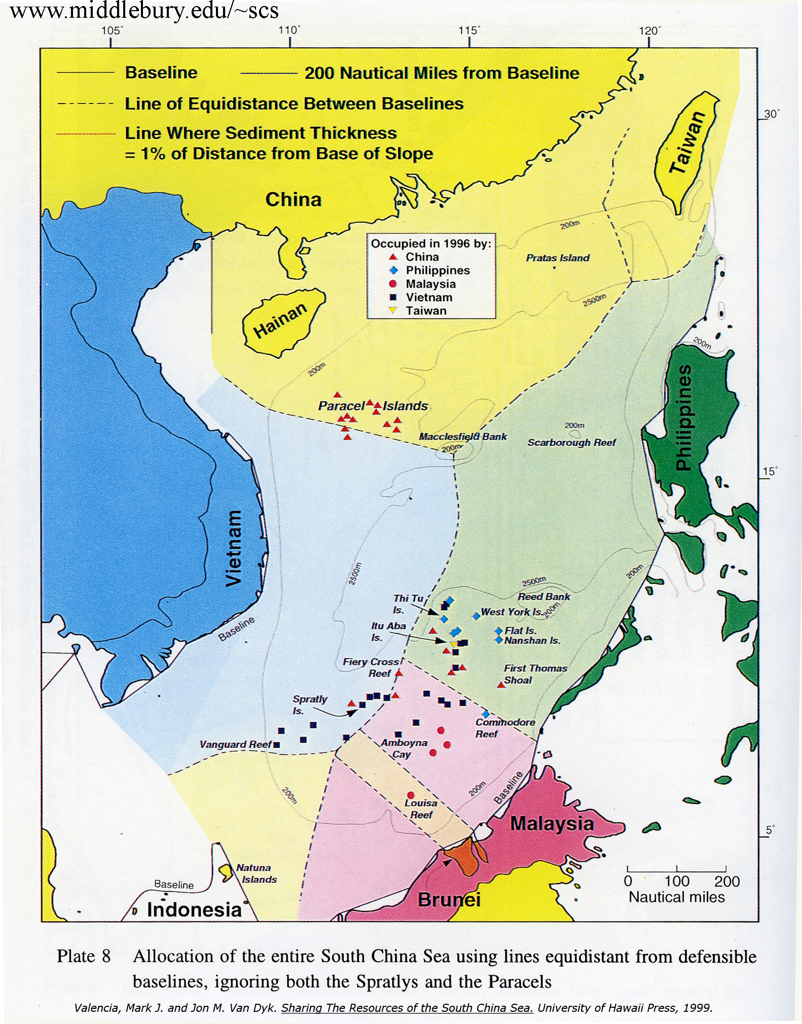
Map 1: Full allocation of the SCS without consideration of Spratlys or Paracels.
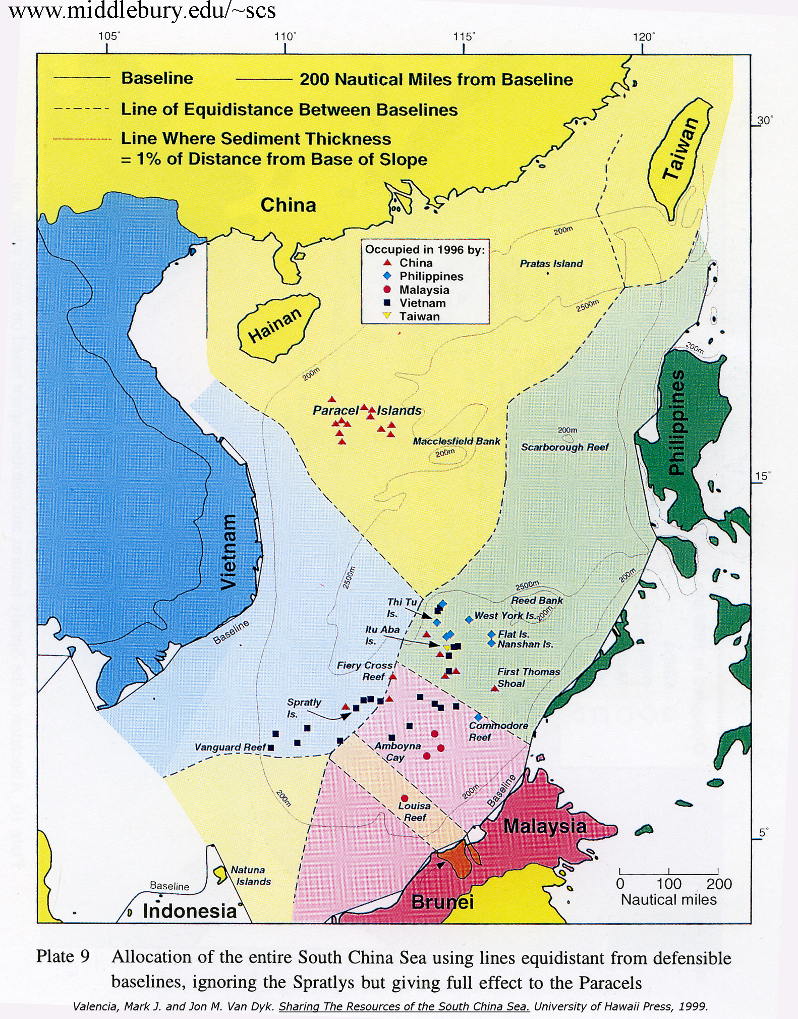
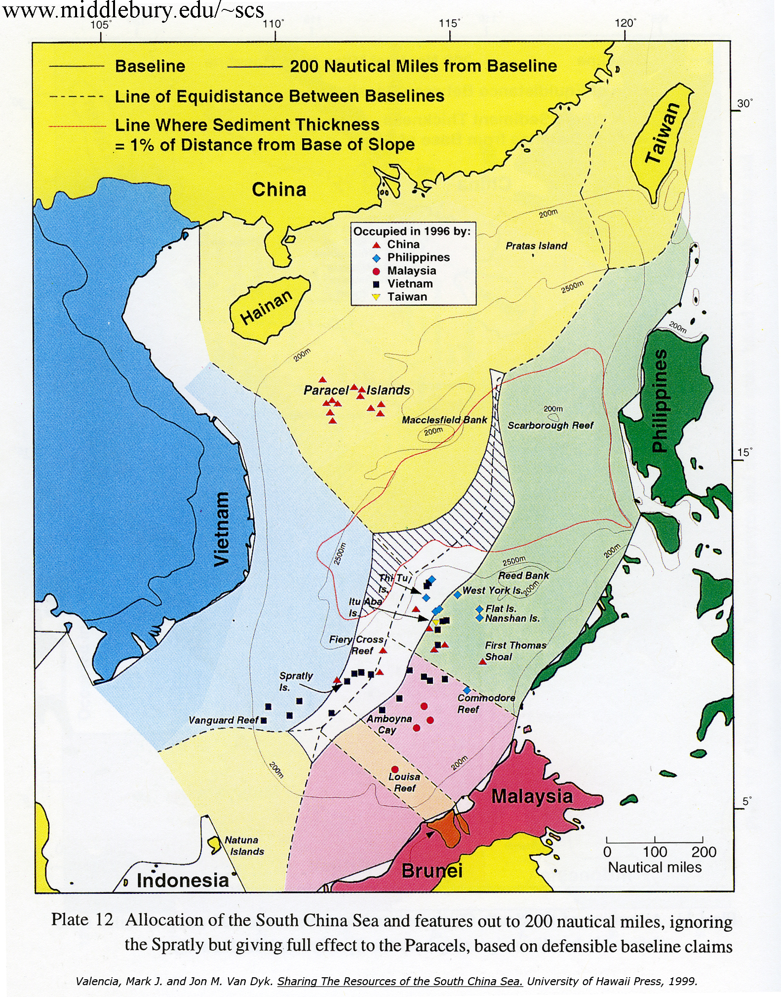
Map 2: Full allocation of the SCS taking into account ownership of the Paracels.
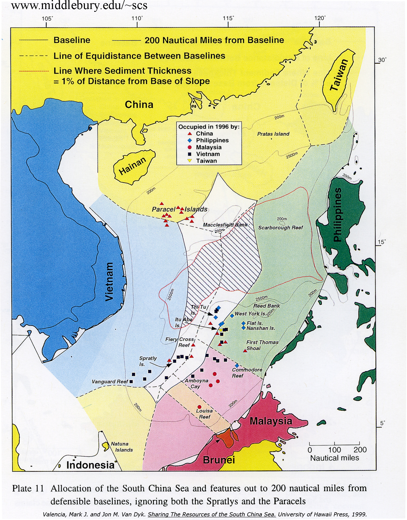
Map 3: 200 mile boundaries without consideration of the Spratlys or Paracels.
Map 4: 200 mile boundaries taking into account ownership of the Paracels.

Leave a Reply Cancel reply

You must be logged in to post a comment.

Search this Site

Google Web Search

  • Environment
  • Fisheries
  • Malacca
  • Piracy
  • Pollution
  • Ports
  • Security
  • Shipping
  • Spratly

Login

  • Log in
  • Entries feed
  • Comments feed
  • WordPress.org
Editor: David Rosenberg
About this Site
Proudly powered by WordPress