|
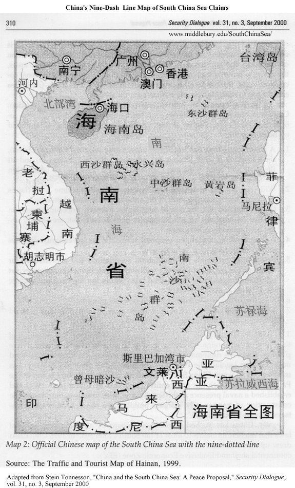
9-Dash Line Map – PRC
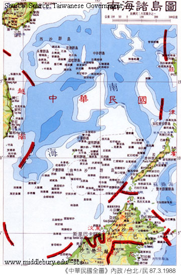
9-Dash Line Map – Taiwan
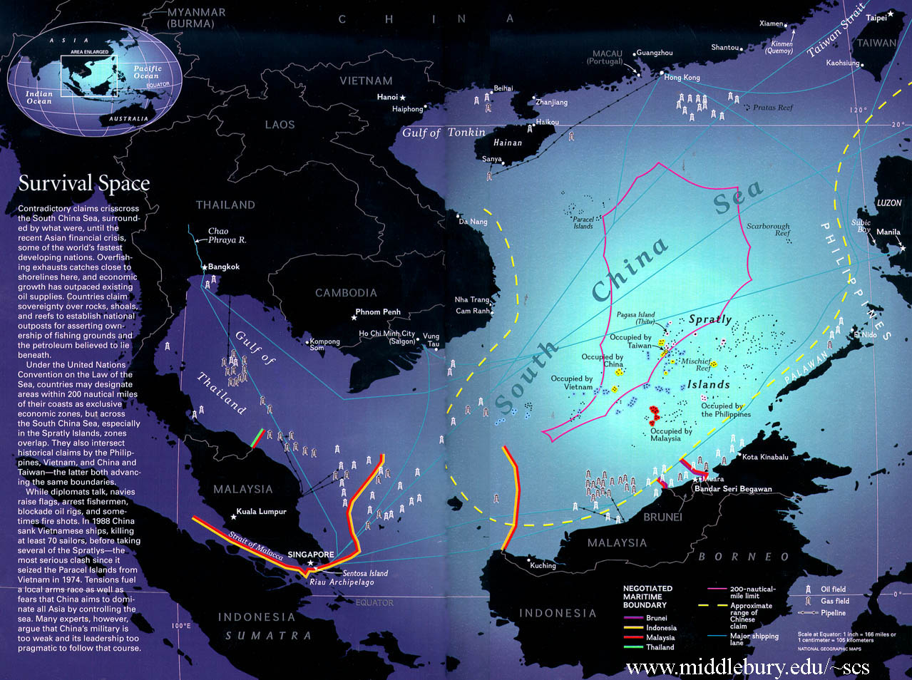
EEZ Claims and Hydrocarbon Resources, NGS
EEZ Claims and Hydrocarbon Resources, SCS WWW
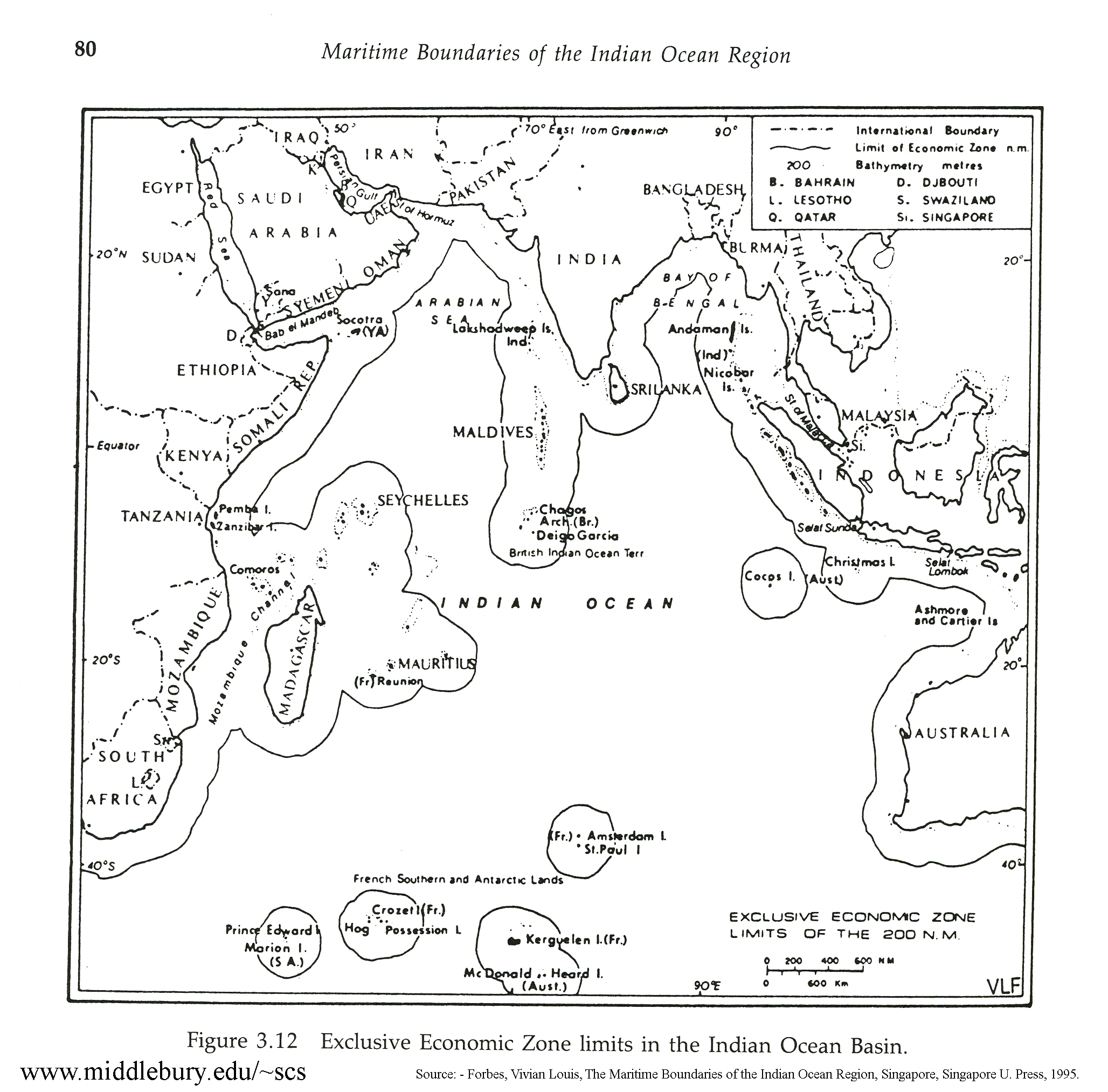
EEZ Limits in the Indian Ocean Basin
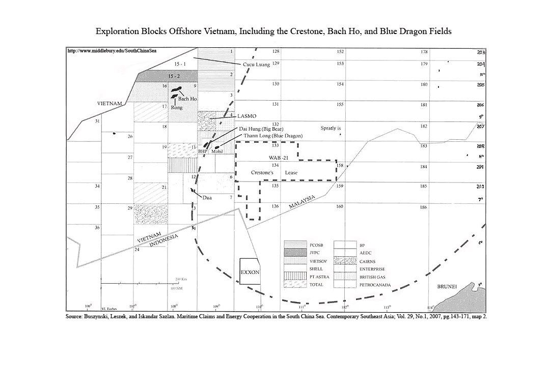
Exploration Blocks Offshore Vietnam
Interactive Map of the Spratly Islands
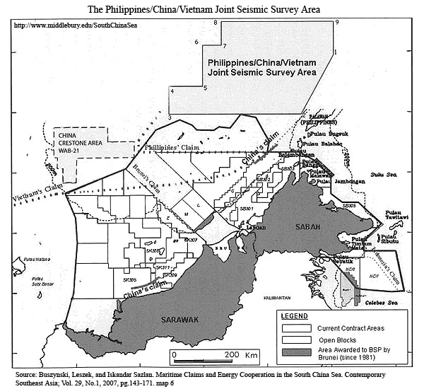
Joint Seismic Survey Area
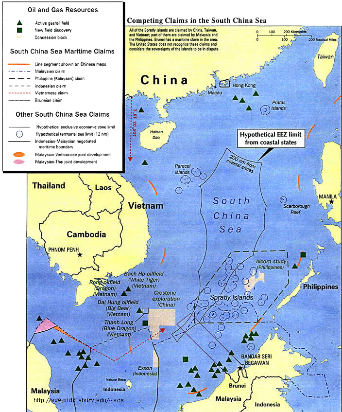
Overlapping EEZ Claims and Oil Fields
Resource Sharing – Four Scenarios, Valencia et al
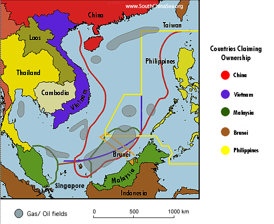
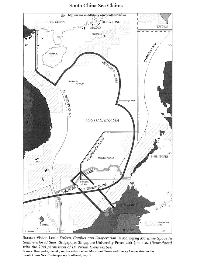
South China Sea Claims
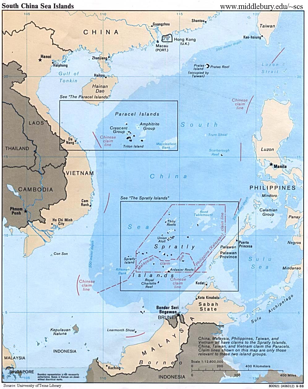
South China Sea Islands – University of Texas
South China Sea Tables and Maps – US EIA
Spratly Islands – Conflicting Claims, SCS WWW VL
Spratley Islands – Taiwan
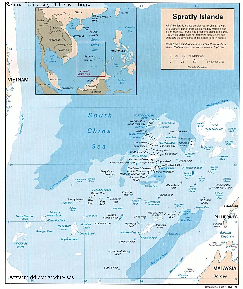
Spratly Islands – U of Texas
Taiwan’s Boundary Claims – Postal Stamp Images
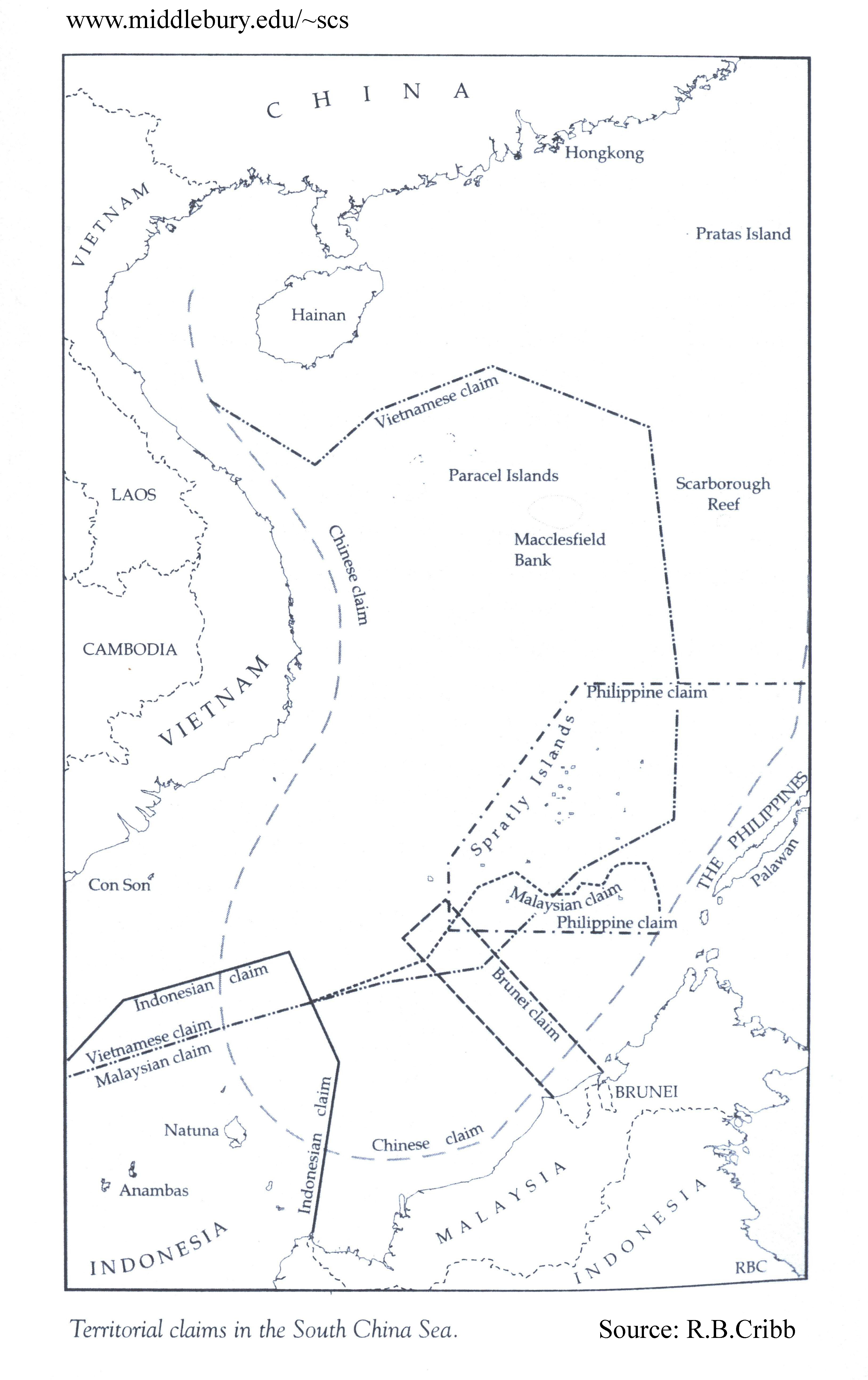
Territorial Claims in the south China Sea – R.B. Cribb
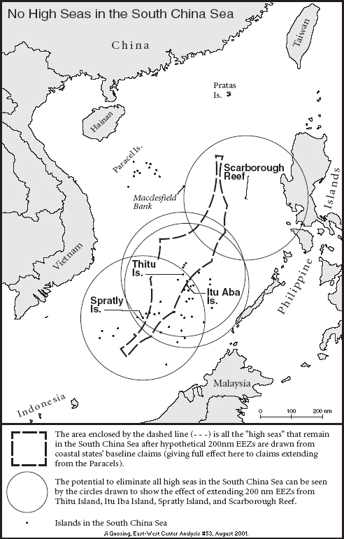
Unclaimed Areas of the South China Sea – Ji Guoxing
|
