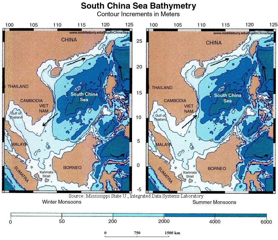
Bathymetry, contour increments in meters
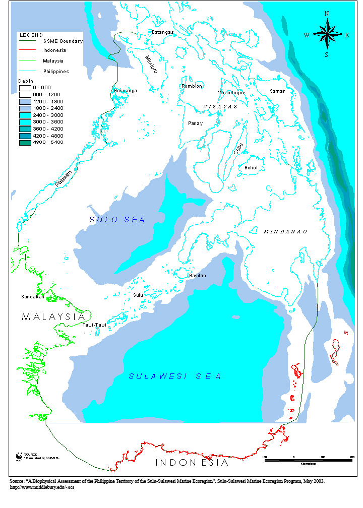
Bathymetric contours of the SSME
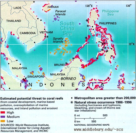
Coral Reefs and Potential Threats
EEZ Ecosystem Resources, Sea Around Us Project
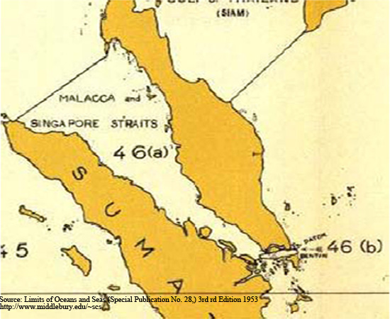
Geographical Setting: Straits of Malacca & Singapore
Marine Protection Areas in South East Asia
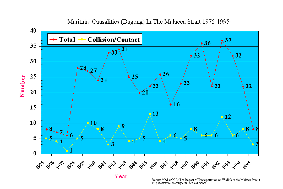
Maritime Causalities – Malacca Strait
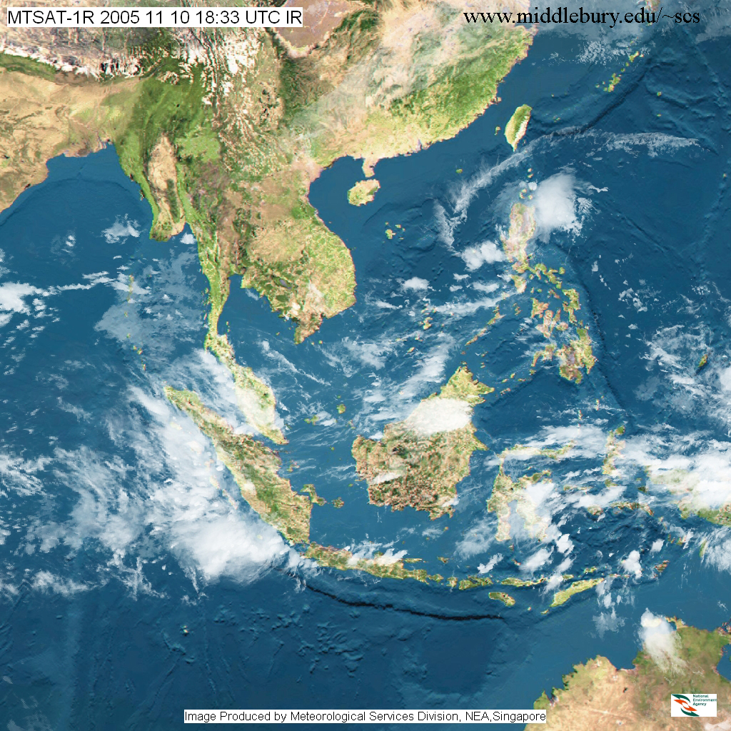
MTSAT Satellite view, Nov, 2005
NOAA & MTSAT Satellite Images
Oil Slick Map-CRISP
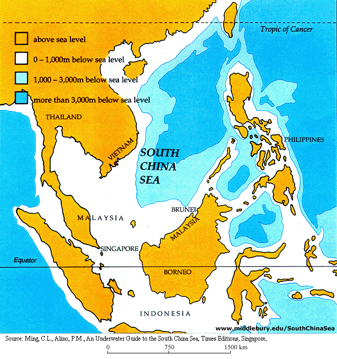
Sea floor depths
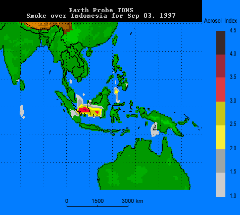
Smoke Haze-1997 Crisis – NOAA, Nov. 3, 1997.
Smoke Haze, Animation – Daily, Sept.-Oct.-Nov., 1997
Smoke Haze, Animation – Weekly, Sept.-Oct.-Nov., 1997
Smoke Haze – Daily PSI reading
Smoke Haze Map – Hourly Update
Spratly Islands Map
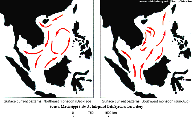
Surface current patterns
The Coral Triangle
The Seas of East Asia-PEMSEA
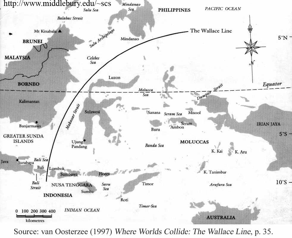
The Wallace Line
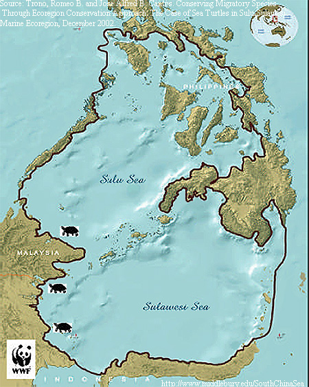
Turtle Habitats
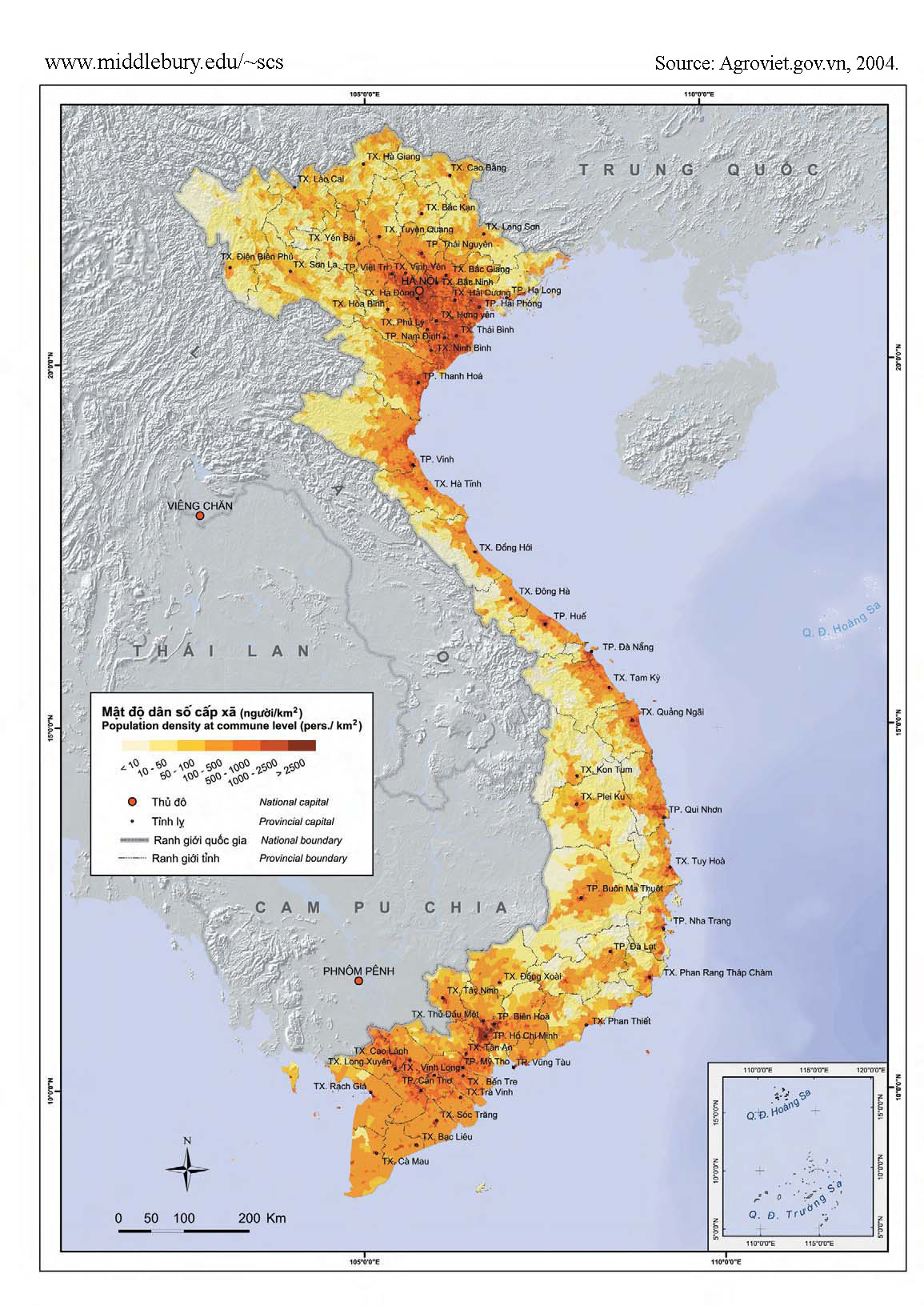
Vietnam – Population Density
The South China Sea
An online resource for students, scholars and policy-makers interested in South China Sea regional development, environment, and security issues.