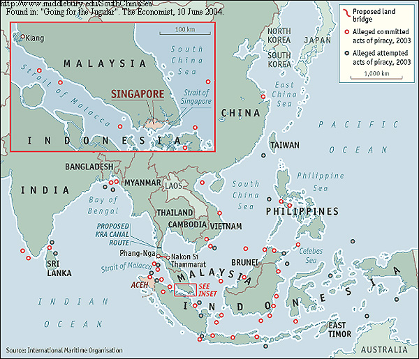
2003 Attacks: Committed & Attempted
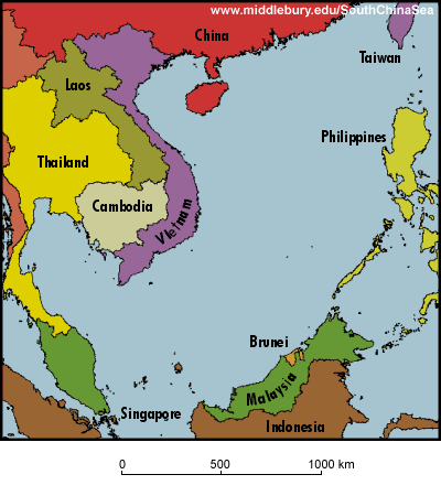
Base Map of the South China Sea
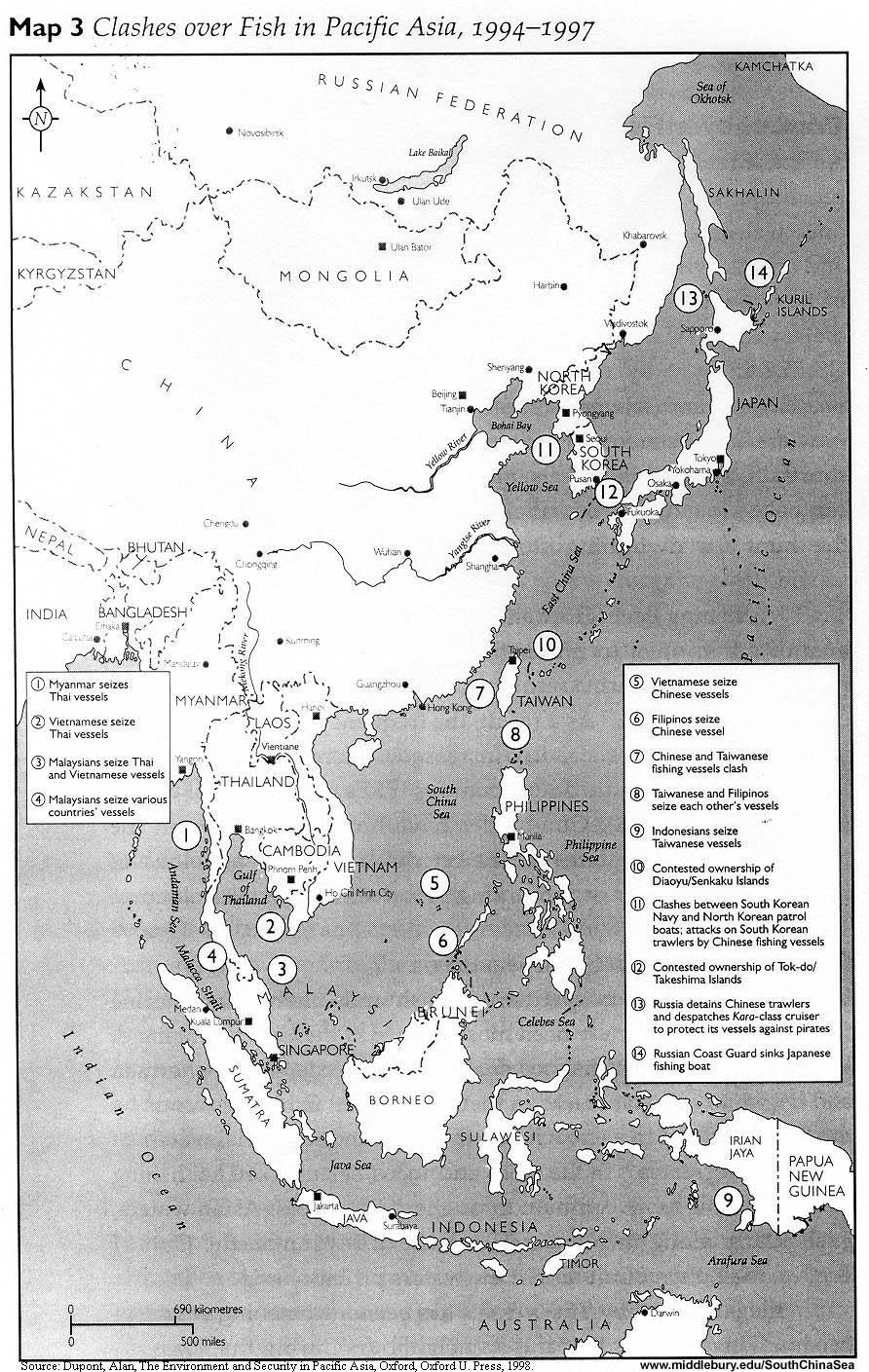
Clashes over fish in Pacific Asia
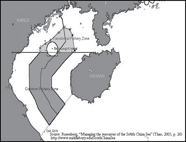
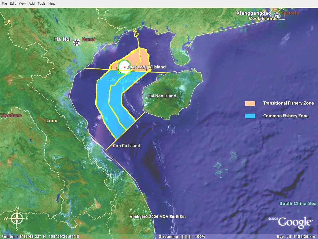
Delimitation Line and Joint Fishing Zones (Tonkin Gulf)
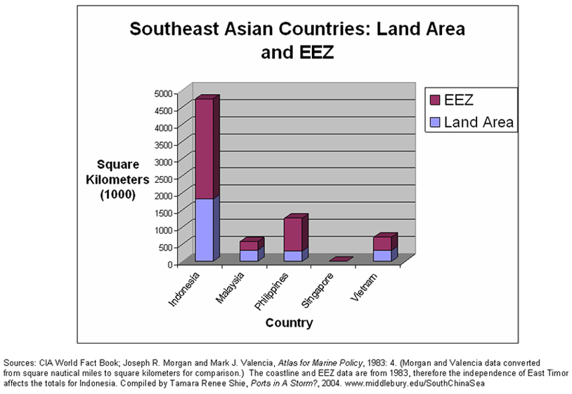
EEZ Claims Compared to Land Area
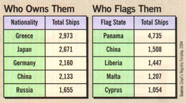
Flags of Convenience
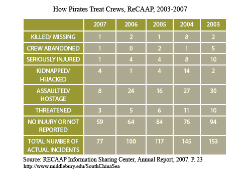
How Pirates Treat Crews
IMB Piracy Reports, World Total, 1992-2003
IMB Piracy Reports, Malacca Straits, 1993-2003
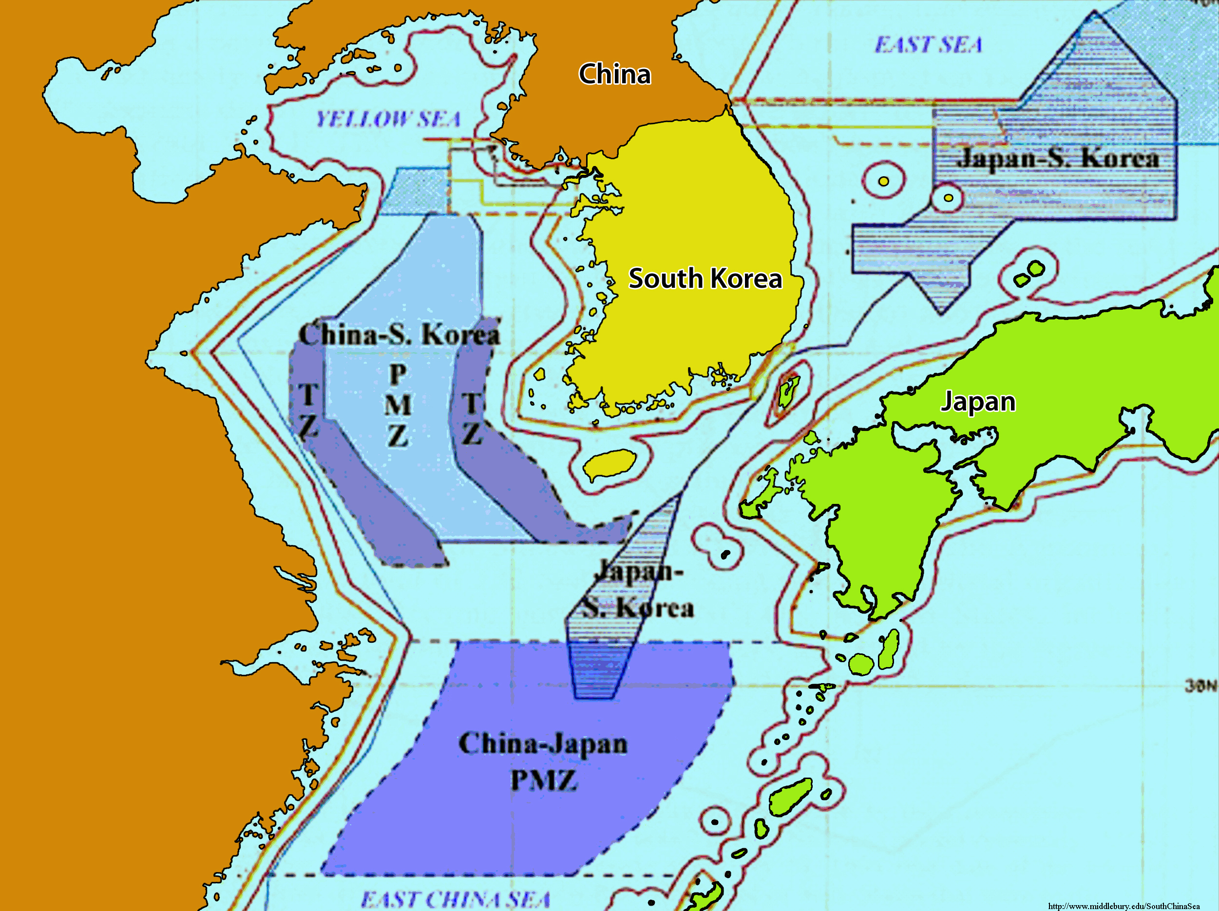
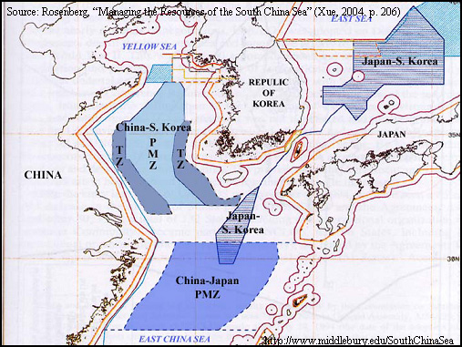
Japan China Korea TZs & PMZs
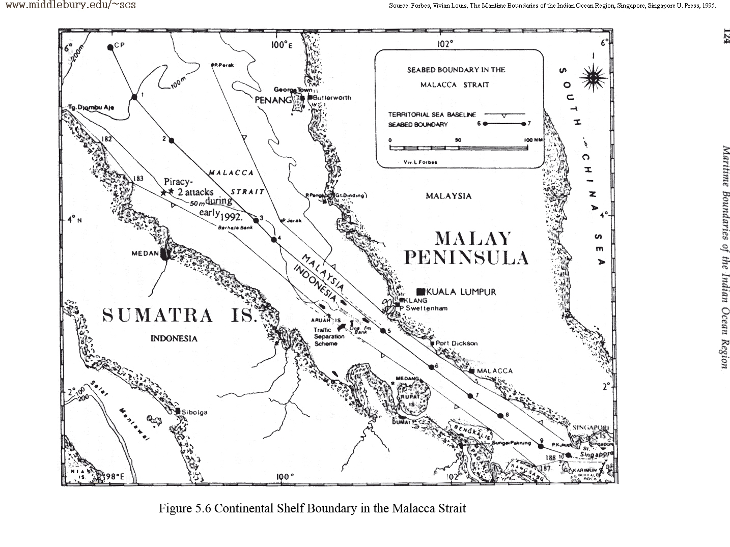
Malacca Strait – Continental Shelf Boundary
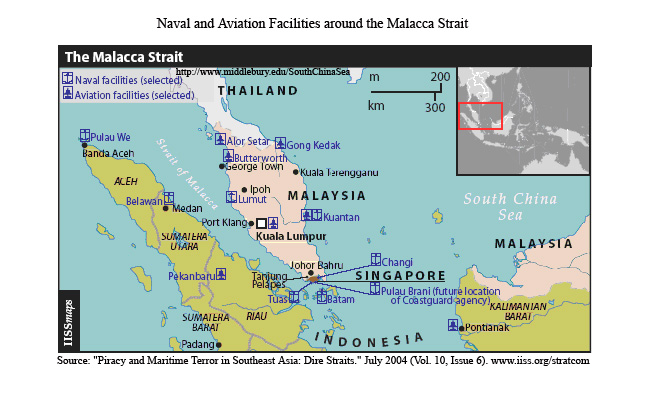
Malacca Strait: Naval & Aviation Facilities
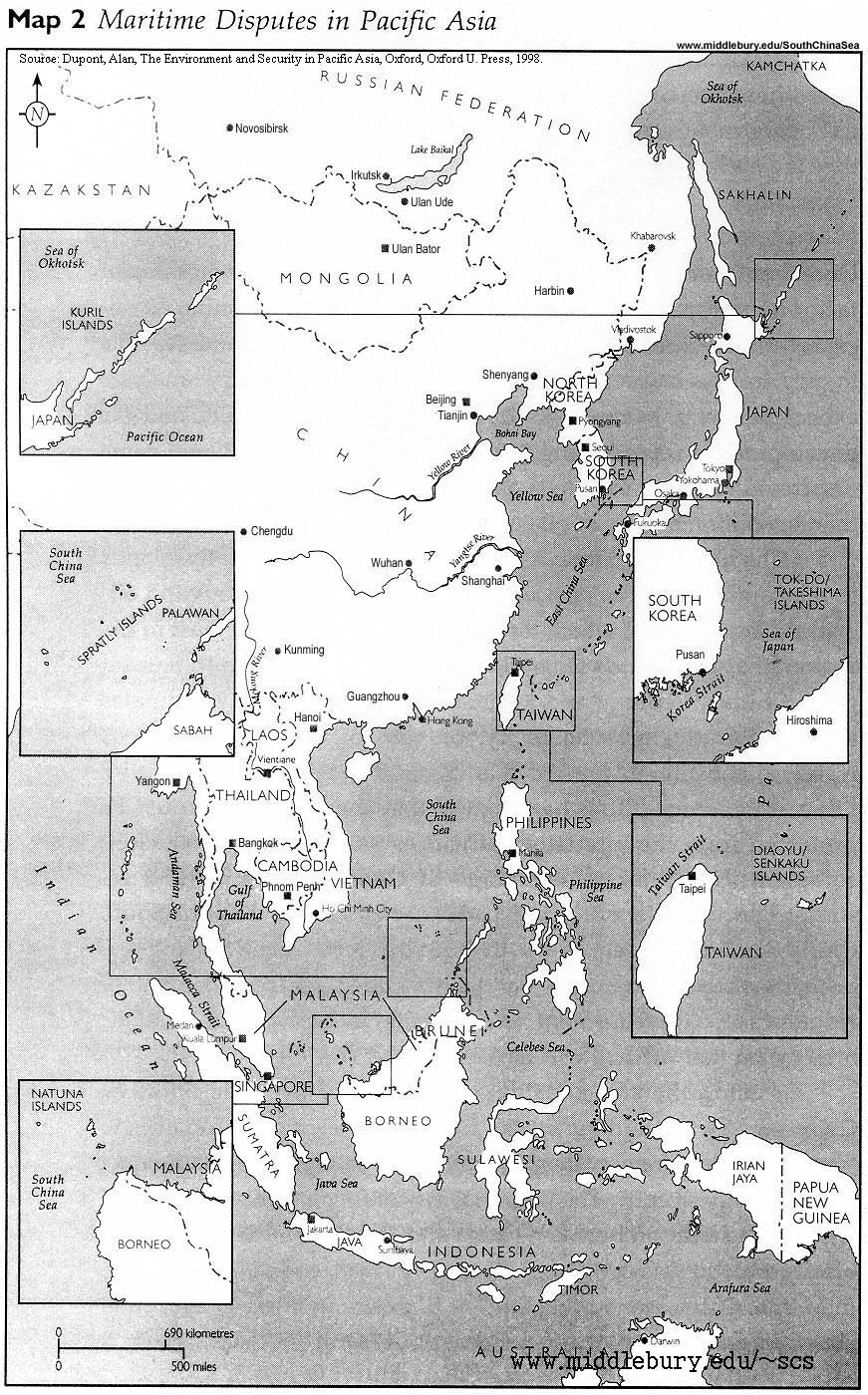
Maritime disputes in Pacific Asia
Maritime Jurisdiction – Singapore Straits
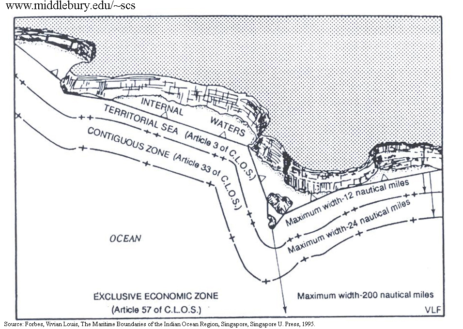
Maritime Jurisdictions – UNCLOS Guidelines
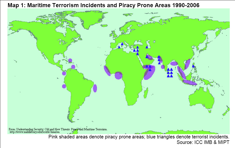
Maritime Terrorism & Piracy Prone Areas
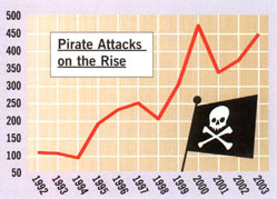
Modern Day Piracy Statistics
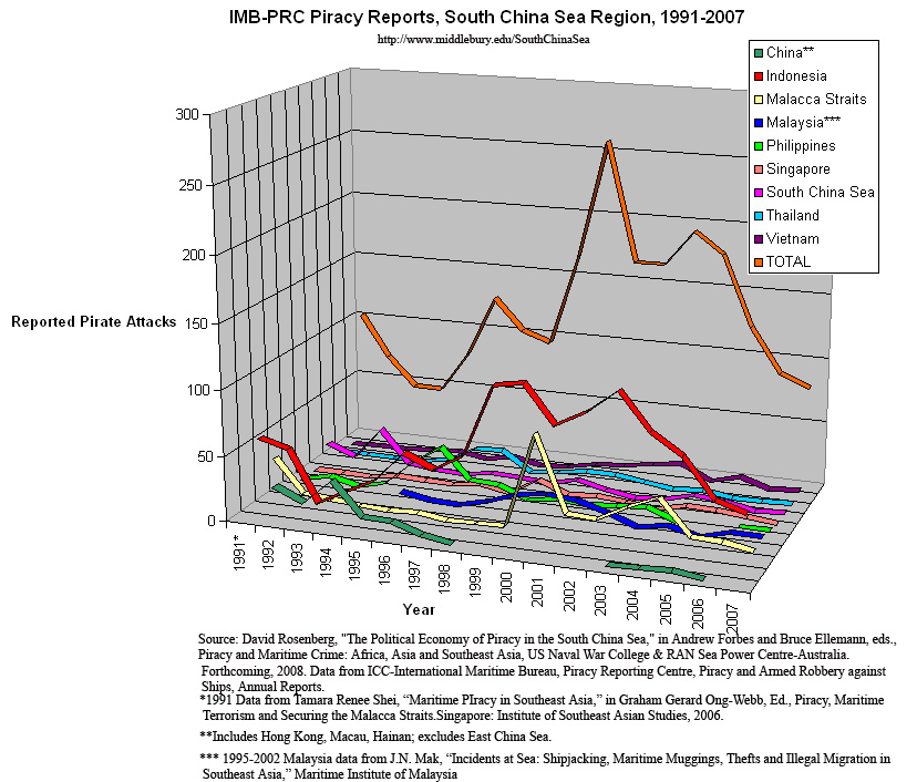
Piracy and Armed Robbery, ICC-IMB, PRC
Piracy Reports by Country
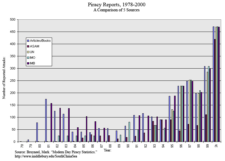
Piracy Reports, Actual & Attempted
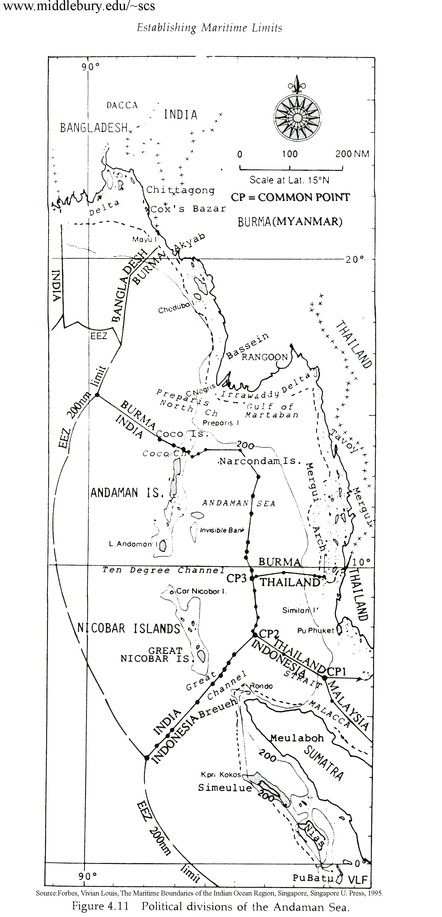
Political Divisions of the Andaman Sea
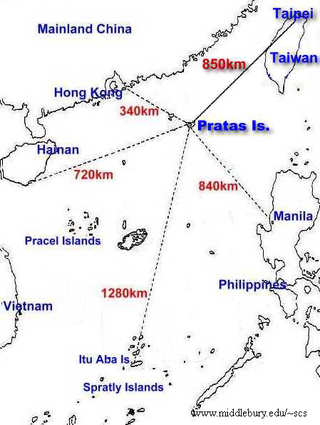
Pratas – Travel Distances
Sino-Japan/Sino-Korean Fisheries Agreements
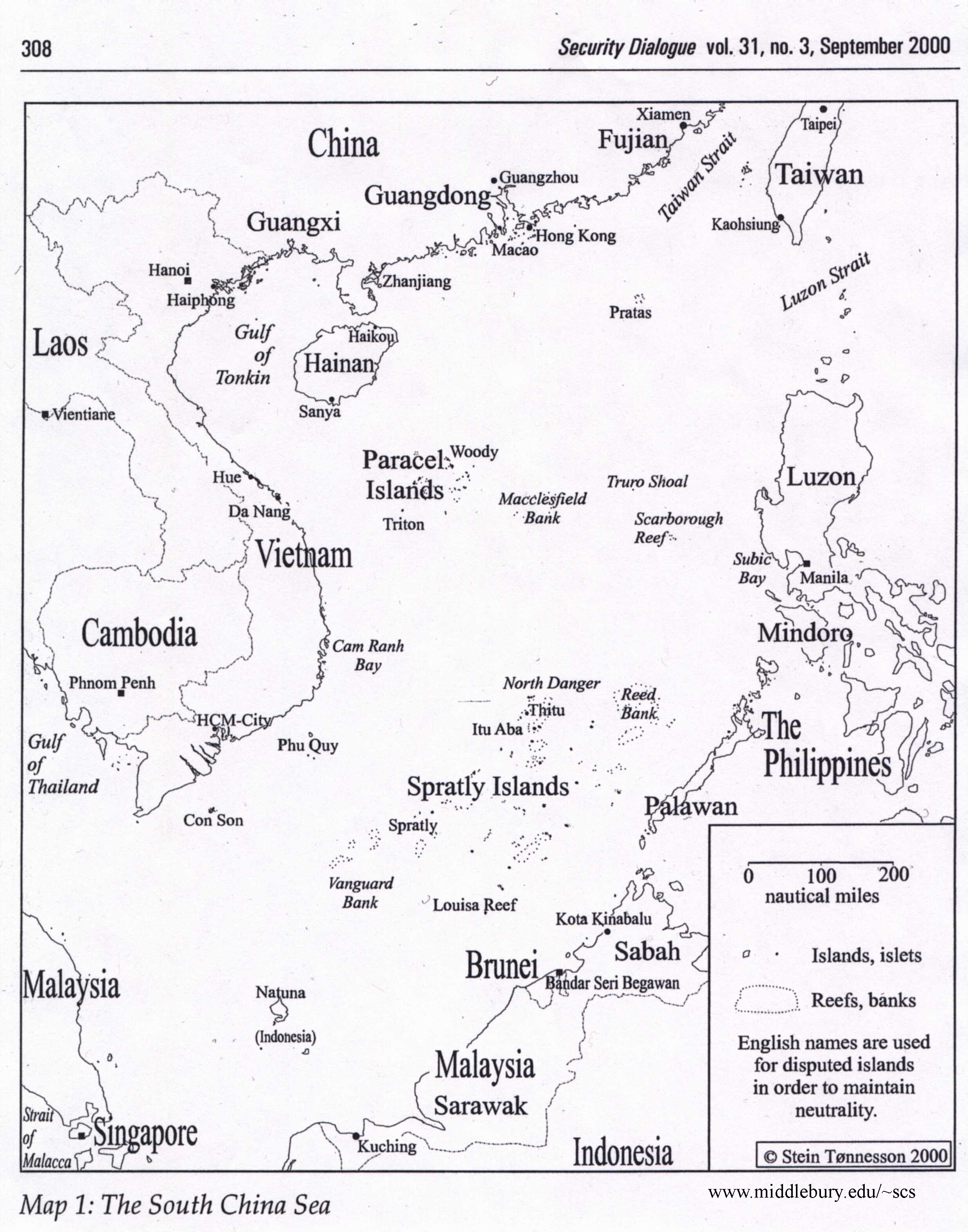
South China Sea Base Map – Tonnesson
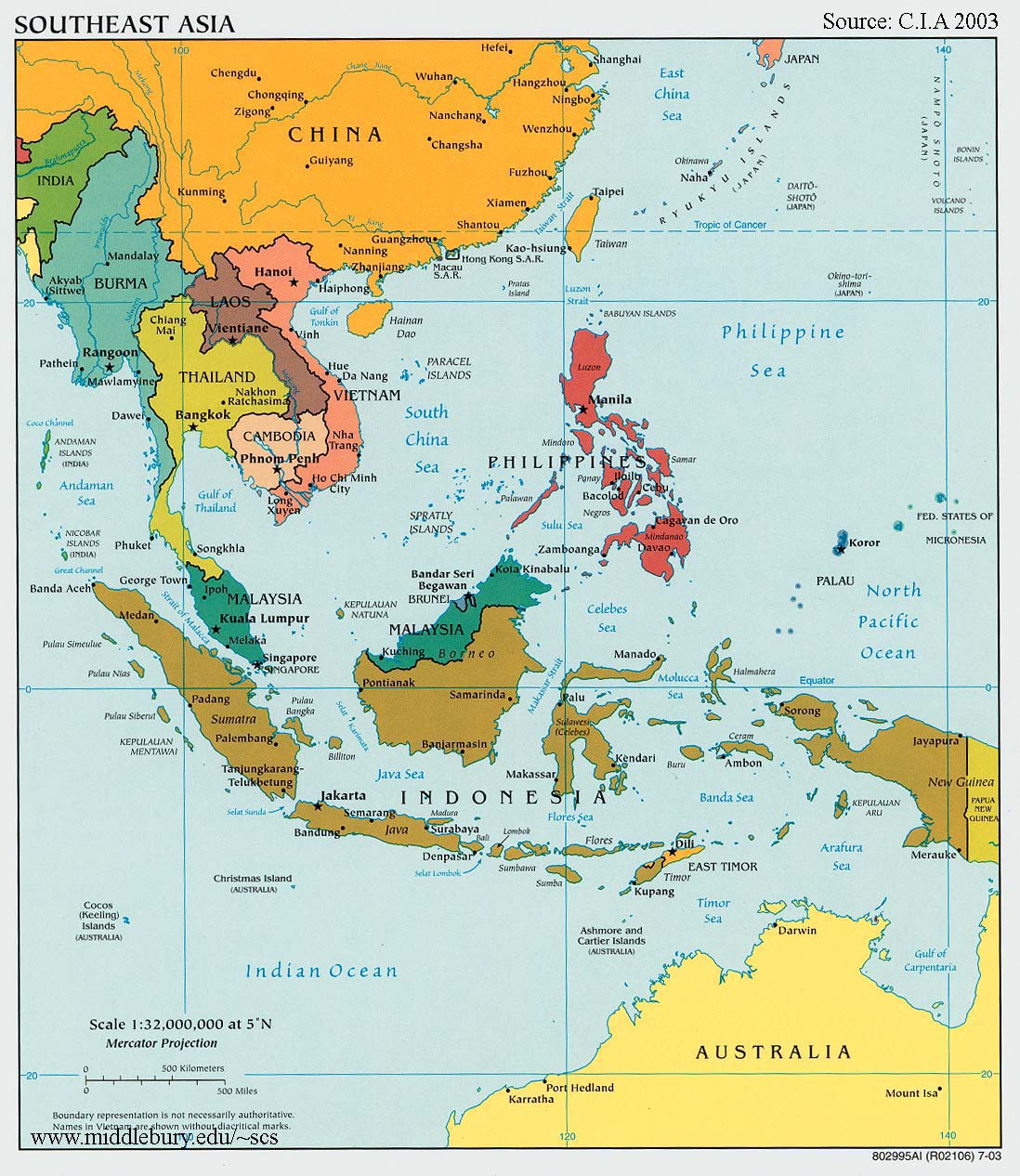
Southeast Asia Reference Map – CIA
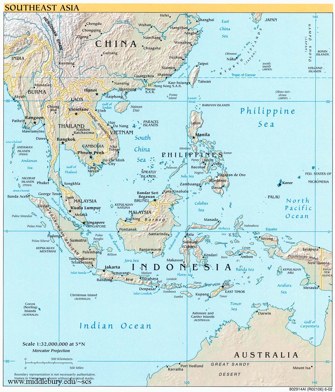
Southeast Asia Base Map – R.B. Cribb
Southeast Asia – Political Map – CIA
Southeast Asia Reference Map – CIA (large)
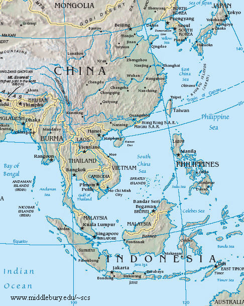
South China Sea – reference map – CIA (small)
Tonkin Gulf JRMZ
The South China Sea
An online resource for students, scholars and policy-makers interested in South China Sea regional development, environment, and security issues.