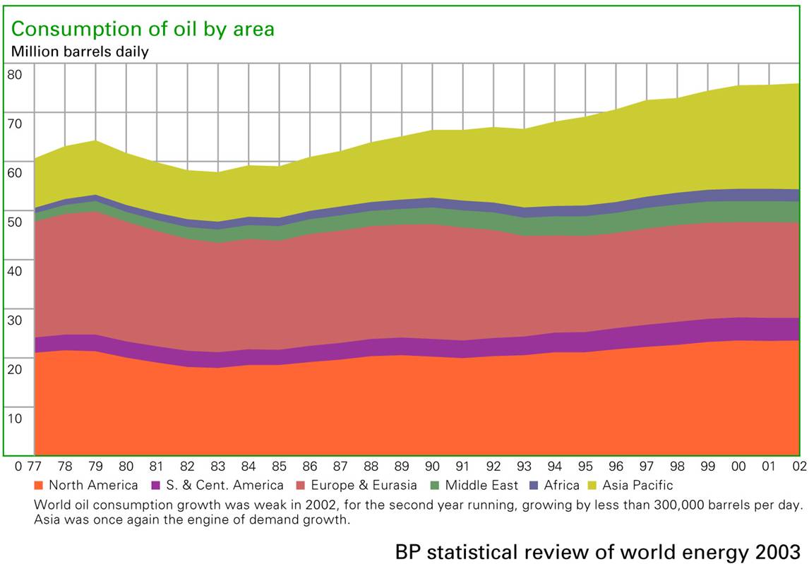
BP-oil consumption trends
China-oil imports
Cities of Asia
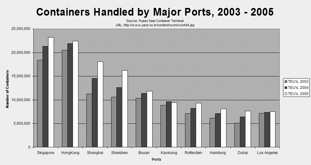
Containers Handled by Major Ports
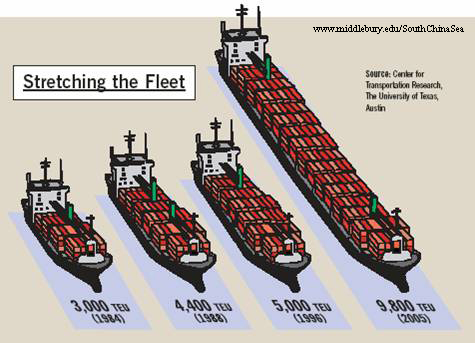
Container Ship Sizes – “Stretching the Fleet”
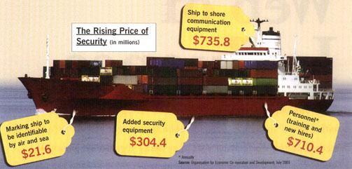
Cost of Ship Security
Crude Oil Trade Flow, 1993
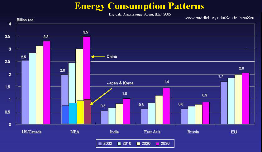
Energy Consumption Patterns
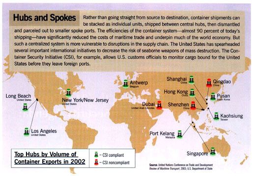
Hubs and Spokes
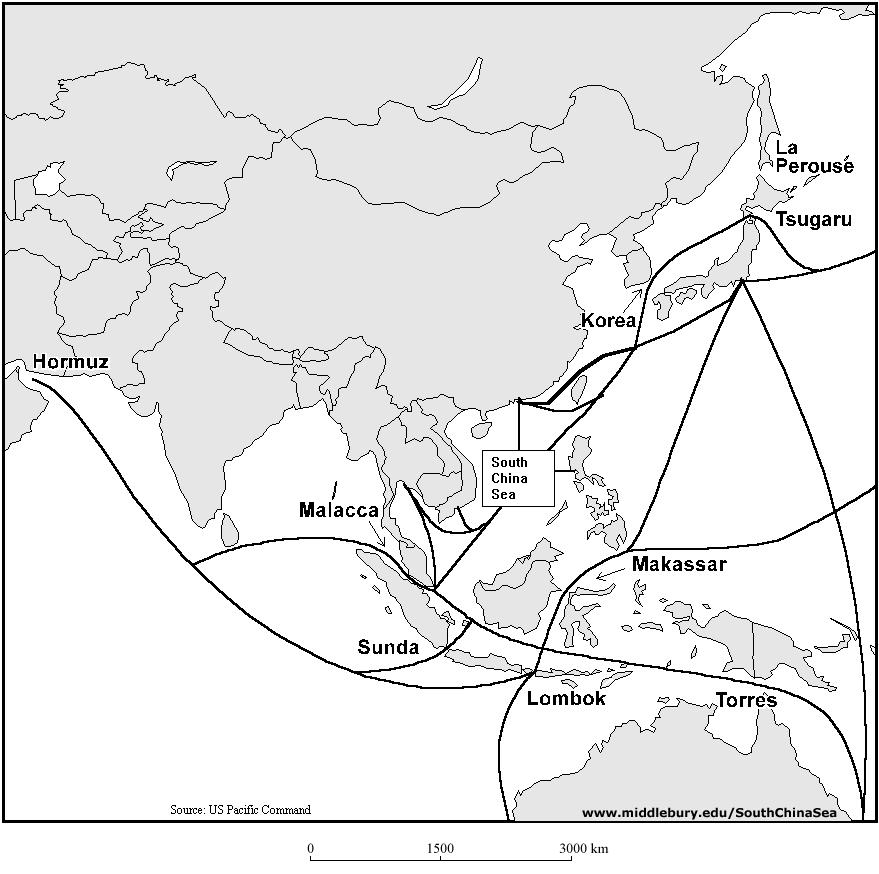
Major Asia-Pacific Shipping Lanes
Major Oil Flows and Chokepoints-2003a
Major Oil Flows and Chokepoints, 2003b
BP-Major Oil Trade Movements, 2005
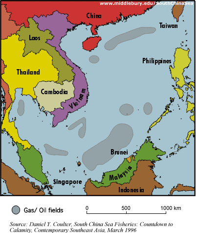
Oil and natural gas fields
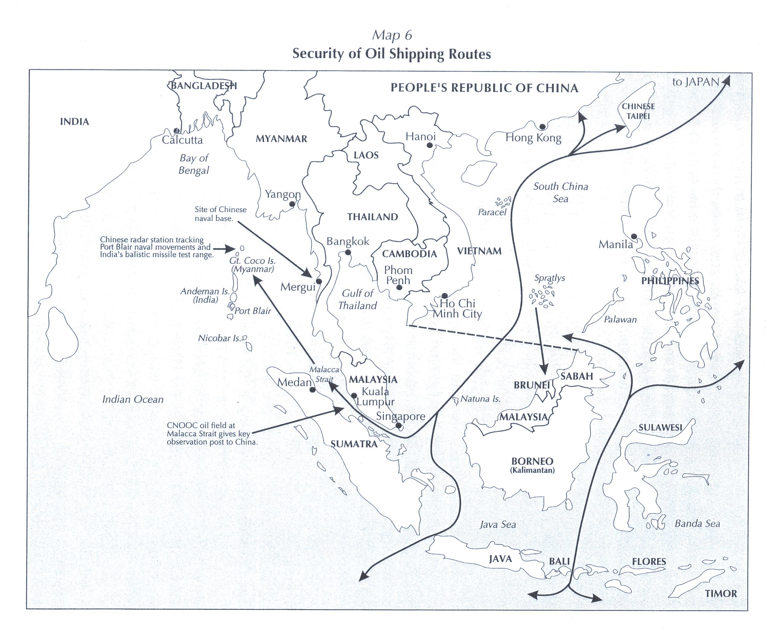
Oil Shipping Routes
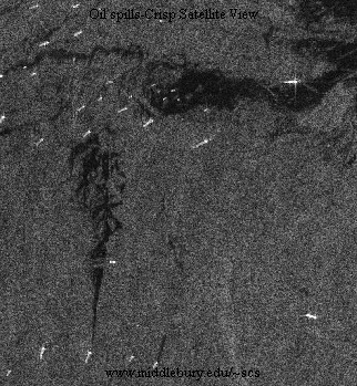
Oil spills-CRISP Satellite View
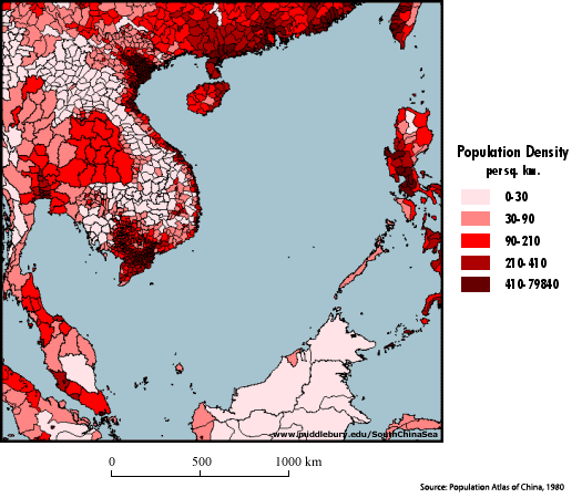
Population density of coastal states
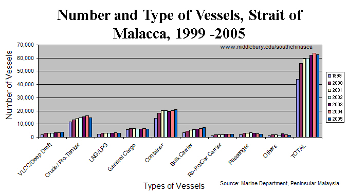
Shipping Traffic, Number & Type of Vessels, Strait of Malacca
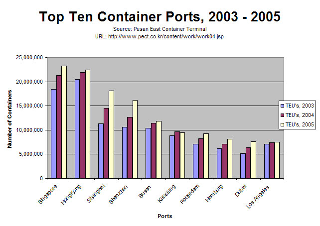
Top Ten Container Ports, 2003 – 2005
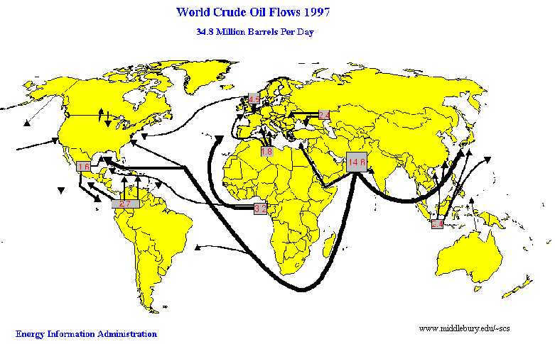
World crude oil flows, 1997
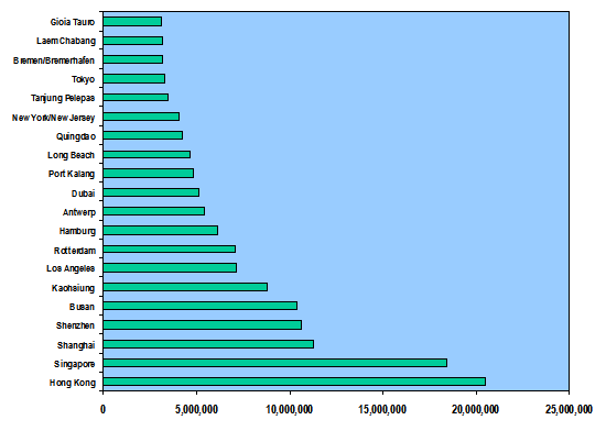
World Top 20 Container Ports, 2003 (in TEUs)
The South China Sea
An online resource for students, scholars and policy-makers interested in South China Sea regional development, environment, and security issues.